How the Rawda Nilometer Measured the Nile in Cairo
Follow the Nile through three tunnels to the Rawda Nilometer’s stone well and marked marble pillar. See how flood readings informed canals and taxation.
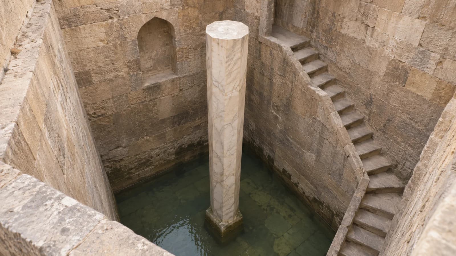
The Rawda Nilometer in Cairo measured the height of the Nile. Three tunnels linked the river to a stone-lined well. As the river rose, water entered the well and climbed against a graduated marble pillar. A reader could compare the water surface with the marks on the pillar. The measurement helped people assess the season’s flood and make decisions about canals, dykes and agricultural taxation.
The surviving gauge on Rawda Island is also known as al-Miqyas. Egypt’s Ministry of Tourism and Antiquities dates the Abbasid structure to 861 CE, during the reign of Caliph al-Mutawakkil. Its measuring system becomes clearer if you follow the water from the river into the well before looking at the scale.
How the river reached the measuring well
In a section through the Nilometer, the key connection is sideways. The chamber extends down from the island’s surface, and tunnels bring water into it from the river. Archnet describes three tunnels. The Museum With No Frontiers record locates the three openings on the east side of the well. An architectural section reproduced by Margaret S. Graves identifies the openings at different levels. Their purpose in the building is easier to grasp if you trace the route from river to tunnel, from tunnel to chamber, and from chamber water to the measuring pillar. Archnet, Miqyas and Margaret S. Graves, Arts of Allusion, chapter 5 and figure 5.3
When water has a clear connection between the river and the chamber, the water surface in the well can serve as a local indication of river level. The interior provides a fixed place to observe the height against a permanent scale. That is the physical inference the arrangement supports. It does not require an assumption that the historical gauge tracked every short fluctuation or that all tunnels carried water at every height. A section shows the connection and its elevations. It cannot, by itself, establish how swiftly the two surfaces responded to each other.
The khettara and foggara channels of North African oases convey groundwater along a gentle gradient for use elsewhere. Rawda’s tunnels admitted river water to a measuring chamber. The destination of each passage helps explain its purpose. For an oasis channel, follow the route to a point of use. At Rawda, follow the route to the well where a reader could compare the water with a scale.
What the shaft, stair and pillar each did
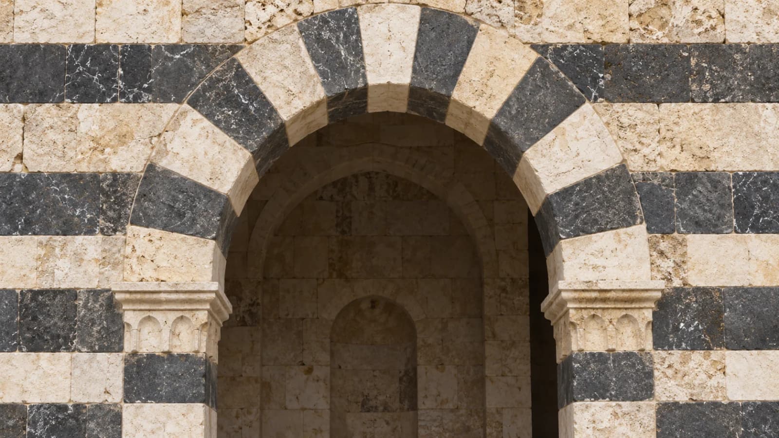
The lower part of the stone-lined well is circular. Museum With No Frontiers describes two square levels above it, with the upper one wider than the middle one. A stair follows the inside walls down toward the bottom. The octagonal marble pillar stands in the middle. Together these elements make three separate parts of the design visible. The shaft contains the changing water surface. The stair gives access to different depths. The marked pillar provides the vertical reference. The architectural record also describes pointed arches at the tunnel openings. Museum With No Frontiers, monument record and photographs
When looking at an interior photograph, use the edge of a stair tread or the boundary between two levels to orient yourself. Then look for the faces of the central pillar. If the photo was taken from above, the pillar may appear shortened and the middle level may hide part of the lower chamber. A section or a second view can explain what the photograph leaves out. A broad view of the well conveys the arrangement, while a close view of the stone is better for finding the marks.
What a cubit reading tells you
The reading was a height on the scale. Imagine a water surface meeting a particular mark on the pillar. A reader notes that mark, and a later reading can show that the surface has risen or fallen. Graves describes cubit and finger measurements on the column. The term cubit here refers to a historical unit on the gauge. When using a figure from a historical account, keep its unit and the date of the account with it. A single modern conversion can hide differences in how historians describe the scale or reconstruct the underlying series.
Two institutional descriptions also differ on the column’s length. Egypt’s Ministry describes it as 19 cubits long. The Museum With No Frontiers entry describes the octagonal marble pillar as 16 cubits long. Those are statements about the object in the respective records. Sixteen cubits also occurs as a flood reading in a separate historical context. Graves discusses the late tenth-century geographer al-Muqaddasi, whose account associates a reading of twelve cubits with a notice of the rising river and sixteen with rejoicing. The reported reading concerns the water surface. The two museum and ministry accounts concern the pillar. If describing the building, attribute each dimension to the record that gives it. Egyptian Ministry of Tourism and Antiquities, Rawda Island Nilometer and Graves, chapter 5
Why flood height mattered for canals and taxation
Seasonal floodwater could reach land that depended on it for cultivation. The Ministry’s account explains that flood readings helped people prepare dykes and canals and that expected agricultural productivity was relevant to taxation. A reading was one piece of evidence in that chain. Water at the well indicated the level at the gauge, while the delivery of water to particular fields also depended on local terrain and channels. The sources support a historical connection between measurement and administration without giving a single tax formula that applied everywhere.
One way to make the difference concrete is to compare the gauge with two devices built to move water. A saqiya used a moving chain of containers to raise water. The norias of Hama raised water from the Orontes into aqueducts. At Rawda, the stone well let an observer see a level. The height on the pillar is a different quantity from the volume moved by a wheel or the rate of flow through a canal.
Why the monument has several historical layers
Archnet and the Egyptian Ministry place the surviving Abbasid structure in 861. Museum With No Frontiers identifies Ahmad ibn Muhammad al-Hasib as the supervisor and dates work associated with Ahmad ibn Tulun to 873. The institution’s record distinguishes the Abbasid foundation from changes to the inscription bands and later renovations. It also describes replacement of the exterior covering in the twentieth century. The date of the hydraulic monument and the dates of particular surfaces or roof elements can therefore differ.
The inscriptions have a place in that history. The Ministry describes Qur’anic passages on the walls with themes of water, vegetation and prosperity. The marks used for measuring are on the pillar. Locating the two types of writing helps a visitor understand what each surface was for. The public significance of water can also be seen in later architecture such as Cairo’s sabil-kuttab buildings, which combined a public water facility and a school in a different setting.
The Egyptian entry for Rawda appears on the World Heritage Centre’s Tentative List, with a submission date of 28 July 2003. The entry describes the monument’s location by Historic Cairo, at the tip of the island. The label on that record is important when describing its designation. UNESCO World Heritage Centre, tentative entry 1826
From a single reading to a historical record
A mark on the pillar records a possible level. A written observation adds a date and a measured height. A series assembled by researchers can combine many such observations from different written sources. A study in the Journal of Global History, for example, presents a chart of annual flood heights from 1001 to 1522 in pre-Ottoman-style cubits, with chronicles and later compilations identified in the figure caption. The chart shows what happens when readings from many years are placed on a common axis. Its dates and units are part of its meaning. Cambridge University Press, figure 4 and its source notes
Other Nile gauges help clarify why a recorded number should stay with its location. Archaeologists excavated a limestone well at Tell Timai in the Egyptian Delta and studied it as a nilometer of Graeco-Roman Thmouis. The excavators relate its form to the local waterways. That is a separate site and period from Rawda. A documented gauge gives evidence of how a particular community observed water, with its own structure and physical setting. Silverstein and colleagues, excavation and comparison of the Thmouis nilometer
How to read a plan or photograph of Rawda
Start with the side openings. Check whether you are looking at a vertical section or a photograph into the shaft. In a section, follow the line of each tunnel into the chamber and locate the central pillar. In a photograph, use the staircase and the edges of the well to establish depth before looking for the graduations. A modern picture can show the form of the monument. A written historical reading is the evidence for a particular flood height.
Then ask which number the source is giving. Is it the height of the river on a particular date, the stated length of the pillar, or a value quoted for a historical ceremony? Keep that information next to the number in your notes. When comparing sources, record the institution or author and whether they are describing the building, a single observation, or a later reconstruction of many observations.
Monument records, drawings and historical studies
- Egyptian Ministry of Tourism and Antiquities documents the date, the octagonal pillar and the relationship to canals, dykes and taxation.
- Archnet’s Miqyas record gives the arrangement of the pillar, stair and three passages and documents the monument’s architectural setting.
- Museum With No Frontiers describes the three levels of the well, the east-side openings, the pillar and later renovations.
- Margaret S. Graves, Arts of Allusion, chapter 5 discusses a section drawing and historical readings in cubits.
- Egypt’s Rawda Nilometer submission to the World Heritage Centre records its tentative status and historical setting.
- The Journal of Global History flood series, figure 4 documents a reconstruction of annual levels and lists its written sources.
- Excavation study of the Thmouis nilometer documents a separate gauge in a different river setting.