Balochistan Province: Map, Districts, Population and Geography
A source-based guide to Balochistan's map, 2023 population, districts, divisions, deserts, mountains, coast and the difference between census and current administrative geography.
Balochistan is Pakistan's largest province by area and its least densely settled provincial landscape. Those two facts explain why a map alone can mislead: very large districts may contain relatively small populations, while Quetta and a few urban corridors concentrate people and services. The provincial government reports an area of 347,190 square kilometres, about 43.6 percent of Pakistan. Population and district totals, however, must always carry a date. The 2023 census recorded one administrative geography; later provincial district profiles can reflect subsequent changes. This guide makes those reference dates visible and connects the provincial picture to Quetta, Gwadar, the Makran coast, the Bolan corridor, Ziarat and Mehrgarh.
Key points
- Use the 2023 Pakistan census for population claims and identify its reference geography instead of mixing it with later district lists.
- The province spans highlands, basins, deserts and an Arabian Sea coast; climate and settlement vary sharply across those zones.
- Balochistan is ethnically and linguistically plural, so the provincial name should not be used as a shortcut for one language or community.
- A useful map separates physical geography, census districts, later administrative units, roads, settlements and protected or heritage areas.
Area, location and what a provincial map should show
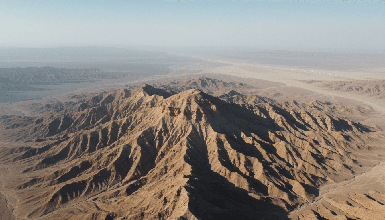
Balochistan occupies Pakistan's southwest, bordering Iran and Afghanistan and meeting the Arabian Sea along the Makran coast. The Government of Balochistan gives its area as 347,190 square kilometres. On a national map it appears as a single immense block, but its internal landscapes include the Quetta and Kalat highlands, the Kharan and Chagai deserts, the Kachhi plain, dry river systems, coastal ranges and ports. Elevation, distance and water availability matter more to everyday accessibility than a straight line on a small map.
Maps should state their purpose and date. A physical map can show ranges, passes, basins, rivers and coast; a census map shows the units used to count people; a current administrative map may contain units established after the census. Combining all three without a legend creates false precision. For research, save the issuing agency, publication date, scale and administrative reference date together with the image.
Population in the 2023 census
Pakistan's Bureau of Statistics is the primary source for the 2023 count. Its provincial report and district table should be used together: the report explains definitions and context, while the table provides district-level figures. A number copied from a search result may refer to the province, a division, a district or the city of Quetta. It may also come from the 2017 census or a projection. Every population statement should therefore include year, geography and source.
Balochistan's low average density conceals strong contrasts. The Quetta urban area has a different settlement pattern from sparsely populated western districts, irrigated pockets of the Kachhi plain or fishing settlements along the coast. Growth rates also need interpretation. They can reflect births, migration, boundary changes, enumeration quality and a small starting population; they are not direct measurements of prosperity or political preference.
Districts, divisions and changing boundaries
The national census report describes Balochistan at the 2023 reference date as eight divisions and 34 districts. The provincial Bureau of Statistics now presents profiles for a larger current set. Both can be correct because they answer different questions. Census tables preserve the units used for that statistical operation, while provincial administration can create or reorganize districts later. A current list should not be retroactively inserted into an older table.
When comparing districts over time, build a boundary crosswalk. Record parent district, split date, legal notification and whether historical figures were recalculated. Without that work, an apparent fall in one district and rise in another may simply result from a new boundary. Readers looking for a current service office need the latest provincial listing; readers comparing population trends need consistent census geography.
Mountains, passes, deserts and the Makran coast
The Bolan corridor links the Kachhi plain with upland routes toward Quetta and has long shaped travel, trade and military history. Farther west, arid basins and mountain chains create long distances between settlements. To the south, the Makran coast contains headlands, beaches, fishing communities, Hingol National Park and Gwadar. These are related landscapes, not interchangeable tourist labels: a coastal journey and a highland winter require different planning and evidence.
Water is a defining constraint. The provincial Water Policy describes an arid system under pressure from groundwater extraction, variable rainfall and climate change, while also identifying wetlands such as Hanna Lake and coastal habitats. A photograph taken after rain cannot establish a permanent lake level, just as a drought image cannot describe every season. Date environmental claims and consult local authorities before travel.
People, languages and religious life
Balochistan is home to Baloch, Brahui, Pashtun, Hazara and other communities, with Balochi, Brahui, Pashto, Urdu and additional languages used in different settings. Provincial statistics do not turn those identities into simple territorial blocks. Cities, migration, intermarriage, work and education produce multilingual lives. A page about the province should name the specific place and source rather than assigning one custom to every resident.
Islam is central to much of the province's public and family life, while the landscape also includes minority histories and living sites such as the Hinglaj pilgrimage complex. Responsible writing does not use Muslim identity to erase ethnic variation or use a heritage site to make claims about all believers. It describes institutions, practices and communities at the scale the evidence supports.
How to research Balochistan without mixing datasets
Start with the Bureau of Statistics and Pakistan Bureau of Statistics, then connect figures to the provincial portal, policy documents and site-specific authorities. Keep a table with field name, value, unit, geography, reference date, publication date and URL. For older maps, retain the original boundary labels. For heritage claims, distinguish an official inscription, a tentative-list proposal, a protected area and a tourism promotion page.
Use this province page as a topic centre rather than an endpoint. Follow direct links to Quetta for the capital, Gwadar for the port, Mehrgarh for archaeology, Bolan for the corridor, Ziarat for the juniper forest and Kund Malir–Hingol for the coast. That structure lets readers move through entities, places and evidence instead of depending on a language homepage or sitemap.
How to read the evidence
Official statistics, government plans, UNESCO submissions, museum records and tourism pages answer different questions. Keep each source's geography, reference date, institutional role and uncertainty visible. Current access, weather, transport and security conditions must be checked close to the intended date.
Related Balochistan reading
- Quetta City: History, Geography, Population and Culture
- Gwadar Port: History, CPEC, Master Plan and Local Context
- Mehrgarh: Archaeological Site, Neolithic History and UNESCO Status
- Bolan Pass: Geography, History and the Route to Quetta
- Ziarat, Pakistan: Juniper Forest, Heritage Status and Ecology
- Kund Malir and Hingol: Makran Coast, National Park and Pilgrimage Landscape
Sources
These sources are linked for verification. A UNESCO Tentative List entry is not a World Heritage inscription, a budget line is not proof of completion, and an institutional plan is not an observed outcome.
- Government of Balochistan — Provincial portal — Official provincial overview and government information, including the province's area and administrative context.
- Balochistan Bureau of Statistics — Statistics and district profiles — Official statistics hub with district profiles and provincial indicators; administrative listings may post-date the 2023 census reference date.
- Pakistan Bureau of Statistics — 2023 Census — Official census hub for definitions, reports, tables and the 2023 reference period.
- Pakistan Bureau of Statistics — Balochistan district population table, 2023 — Official district-level population table for the 2023 census geography.
- Pakistan Bureau of Statistics — Provincial Census Report 2023: Balochistan — Official provincial report describing census geography, population and settlement patterns at the reference date.
- Government of Balochistan — Balochistan Water Policy 2024 — Provincial policy evidence on aridity, water management and wetlands, including Hanna Lake.


