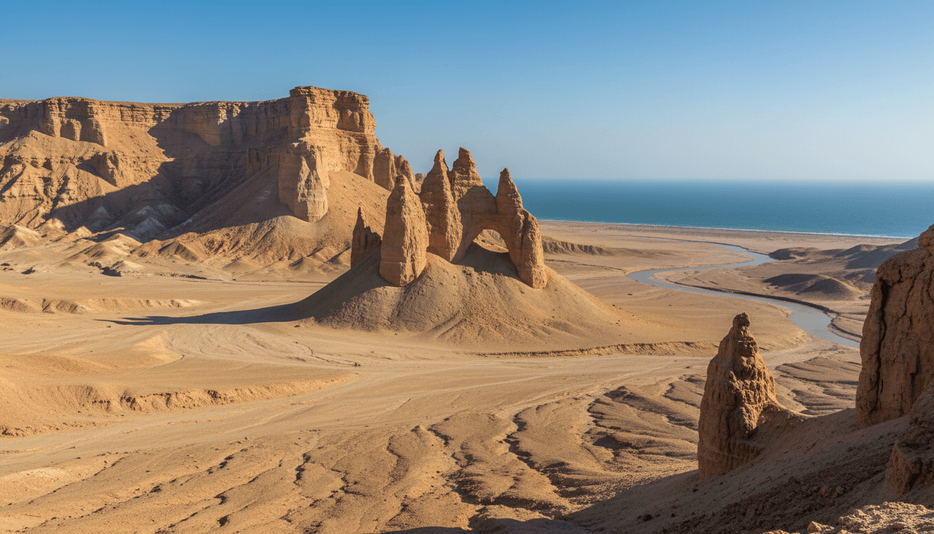
Kund Malir and Hingol: Makran Coast, National Park and Pilgrimage Landscape
A source-based guide to Kund Malir, Hingol National Park and the Makran coast, covering beaches, geology, wildlife, Hinglaj pilgrimage, UNESCO Tentative List status and visitor limits.
Kund Malir is often searched as a beach near Karachi, but it sits within a much larger Balochistan coastal landscape associated with Hingol National Park, the Hingol River, dramatic erosional formations and the living pilgrimage traditions of Hinglaj. Pakistan's UNESCO Tentative List proposal describes Hingol as a cultural landscape; this is not a World Heritage inscription. The National Tourism Portal supplies attraction context, while provincial programmes record development at Kund Malir. None of these pages guarantees road, weather, fuel, water, mobile coverage or permission on a given day. This guide links natural and religious significance without turning a protected landscape into a checklist of photo stops.
Key points
- Kund Malir beach, Hingol National Park and the proposed Hingol cultural landscape overlap in context but are not identical boundaries.
- The UNESCO page is a Tentative List submission, not a World Heritage inscription.
- Hinglaj is a living Hindu pilgrimage landscape within a predominantly Muslim province and should be described with respect for worshippers.
- Remote travel conditions and protected-area rules require current checks, adequate water and responsible waste management.
Locating Kund Malir within the Makran landscape
Kund Malir lies along Balochistan's coast in the wider Hingol and Makran setting. Search results sometimes place every photographed rock formation or beach under the same pin. A reliable map distinguishes the beach, highway viewpoints, park boundary, river, pilgrimage sites and nearby settlements. Coordinates should come from an authority or verified field record, not a copied social-media caption.
The coast combines marine, estuarine, desert and mountain processes. Wind and water erode soft rock into forms that invite imaginative names, but resemblance is not archaeological proof of a carved monument. Describe observable geology first and label popular nicknames as modern visitor names where appropriate.
Hingol National Park and biodiversity claims
The National Tourism Portal describes Hingol as Pakistan's largest national park and lists multiple ecosystems and species. The UNESCO Tentative List submission gives a large landscape figure and emphasizes natural and cultural relationships. Area numbers can differ because sources use different boundaries or rounded values; cite the number with its source rather than averaging them.
Wildlife lists indicate recorded or expected species, not a promise of a sighting. Responsible observation requires distance, no feeding and compliance with park rules. Claims about threatened status should use a current conservation authority and identify whether the status is global, national or local.
Hinglaj and a living pilgrimage route
The Hingol cultural-landscape proposal includes Hinglaj Mata and associated pilgrimage traditions. It is a living religious landscape, not a decorative stop on a road trip. Visitors should follow access rules, dress and photograph respectfully, and avoid interrupting rituals. Descriptions should use names recognized by the community and distinguish observed practice from legend.
The site's presence also demonstrates Balochistan's religious history and contemporary pluralism. A Muslim-focused publication can document that heritage without appropriating it or treating it as a contradiction. Precise writing names the worshipping community, source and event rather than turning minority presence into a generic tolerance slogan.
What development records say about Kund Malir
The provincial Public Sector Development Programme lists a Kund Malir tourism-site scheme with costs, expenditure and targets for that fiscal year. This shows government planning and reported progress, not the current condition of toilets, waste collection, rescue service or accommodation. Later evidence is required before making facility claims.
Tourism investment can improve access while increasing litter, off-road driving and pressure on water and habitats. Evaluation should measure both service and environmental outcomes. A higher visitor count is not automatically a conservation success, and a pristine promotional frame may hide waste just outside the crop.
Planning a remote coastal visit
Road, fuel, water, weather, mobile signal, park permission and security conditions can change. Verify them with relevant authorities and licensed local operators shortly before travel. Carry adequate water and emergency supplies according to current guidance, and do not rely on the availability of stalls or accommodation described in an old listing.
Swimming conditions, tides and currents require local assessment; a calm-looking photograph cannot establish safety. Avoid cliff edges, unstable formations and flash-flood channels. Remove waste and do not drive beyond permitted tracks. Current official restrictions override any evergreen itinerary.
Connecting coast, port and province
The Balochistan hub supplies provincial geography and census context, while the Gwadar page explains a separate port and urban-development system farther along the coast. Ziarat offers a contrasting protected highland ecology. These direct links help readers compare institutions and landscapes without treating all of Balochistan as one destination.
For every image, save date, creator, exact named location, permission and whether it depicts a religious event, wildlife or a public viewpoint. Source roles matter: a UNESCO tentative-list submission describes proposed values, the tourism portal supports visitor context, and provincial budgets document schemes. None should be asked to prove what it does not measure.
How to read the evidence
Official statistics, government plans, UNESCO submissions, museum records and tourism pages answer different questions. Keep each source's geography, reference date, institutional role and uncertainty visible. Current access, weather, transport and security conditions must be checked close to the intended date.
Related Balochistan reading
- Balochistan Province: Map, Districts, Population and Geography
- Gwadar Port: History, CPEC, Master Plan and Local Context
- Ziarat, Pakistan: Juniper Forest, Heritage Status and Ecology
- Quetta City: History, Geography, Population and Culture
Sources
These sources are linked for verification. A UNESCO Tentative List entry is not a World Heritage inscription, a budget line is not proof of completion, and an institutional plan is not an observed outcome.
- UNESCO World Heritage Centre — Hingol Cultural Landscape — Pakistan's Tentative List submission describing the park, Makran landscape and living Hinglaj pilgrimage traditions.
- National Tourism Portal — Hingol National Park — National tourism listing for the park, coast and Kund Malir visitor context; operational details should be checked locally before travel.
- National Tourism Portal — Tourist attractions in Pakistan — Official national attraction directory with Balochistan entries including Hingol and Gwadar.
- Government of Balochistan — Public Sector Development Programme 2023–24 — Official programme record for tourism and public works at Hanna–Urak, Kund Malir and other provincial sites.
- Government of Balochistan — Provincial portal — Official provincial overview and government information, including the province's area and administrative context.
- Government of Balochistan — Balochistan Water Policy 2024 — Provincial policy evidence on aridity, water management and wetlands, including Hanna Lake.


