Bolan Pass: Geography, History and the Route to Quetta
A careful guide to the Bolan corridor in Balochistan, its gorges, seasonal water, links between the Kachhi plain and Quetta highlands, railway history and relationship to Mehrgarh.
Bolan Pass is usually described as a single mountain gateway to Quetta, but the name refers to a corridor of valleys, gorges and route choices rather than one summit road. It connects the Kachhi plain with the highlands of central Balochistan and has carried travellers, trade, armies, railway engineering and local movement in different periods. Its closeness to Mehrgarh gives the wider corridor deep archaeological importance, though it does not prove that every ancient movement followed the modern road. This guide separates physical geography, historical episodes, railway infrastructure and current travel conditions so that a dramatic pass narrative does not erase local landscapes or time-sensitive risk.
Key points
- Bolan is a corridor through rugged terrain, not a single viewpoint with one permanent route.
- Seasonal floods and erosion are part of the geography and can change access rapidly.
- Military and colonial accounts are important sources but should not replace local settlement, trade and labour histories.
- Current road, rail, weather and security conditions require same-day official checks.
From the Kachhi plain to the highlands
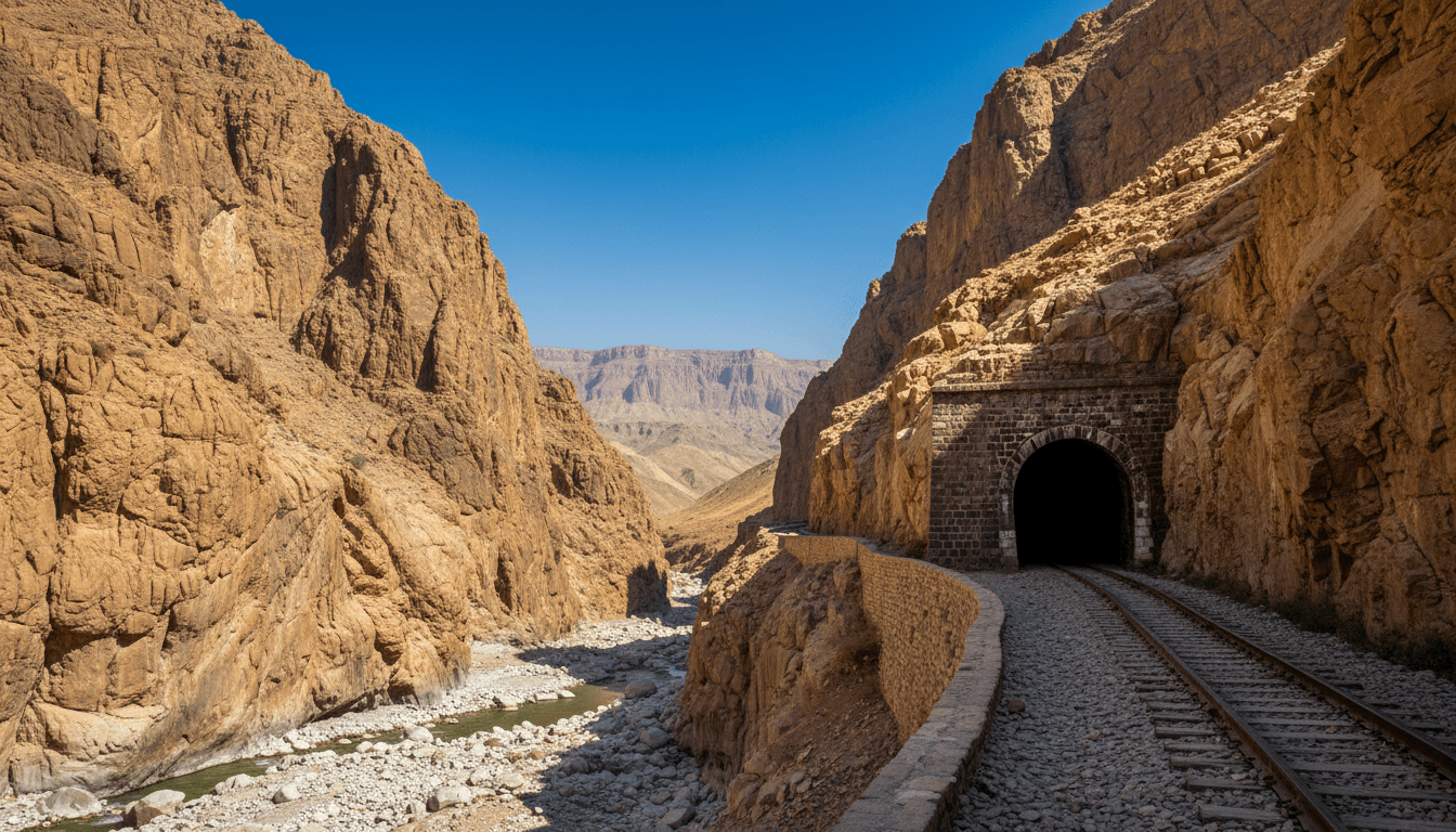
The Bolan corridor rises from the hot Kachhi plain toward the uplands that lead to Quetta. Watercourses cut through folded mountain terrain, producing narrow sections and wider valleys rather than one simple notch. Historical routes could shift with flood damage, engineering and political control. Modern maps should therefore distinguish the broader corridor from a particular highway or railway alignment.
Altitude and enclosure create changing temperature, wind and visibility over a relatively short distance. Dry channels can become destructive torrents after intense rain elsewhere in a catchment. The provincial Water Policy's wider account of aridity and episodic water helps explain why an apparently empty channel is still infrastructure and hazard, not unused land.
Mehrgarh and long-term movement
Mehrgarh lies on the Kachhi plain near approaches to Bolan and preserves a settlement sequence from the seventh to third millennia BCE. Its position supports research questions about movement between highlands, plains and regions farther west. Archaeologists test those questions through raw materials, crops, animals, technologies and burial evidence rather than assuming that the pass functioned like a modern border crossing.
The term route can hide many scales: seasonal herding, marriage, local exchange, long-distance material movement or organized transport. A material found at two sites may have passed through intermediaries. Connect Bolan to Mehrgarh as a geographic relationship, but keep every proposed network tied to dated evidence.
Trade, empire and military narratives
Persian, South Asian, Afghan and later British imperial histories all gave strategic meaning to routes across Balochistan. Military reports often describe terrain, water and communities in detail because armies needed them. Those records are valuable but interested: they organize the landscape around imperial movement and threat. Read them alongside local place names, revenue records, oral histories and archaeology.
Calling Bolan an invasion route reduces centuries of ordinary mobility to a sequence of armies. Merchants, pastoralists, railway workers, pilgrims, administrators and families also travelled through or lived near the corridor. A responsible history asks whose movement a source recorded, who supplied labour and provisions, and which settlements bore the costs of military passage.
Railway engineering and landscape change
Rail development toward Quetta required bridges, cuttings, tunnels, drainage and repeated responses to difficult geology and floods. Engineering histories can date particular alignments and structures, but route names are sometimes used loosely for neighbouring systems. Verify station, line, construction phase and map before captioning an archival photograph.
Infrastructure changes the corridor as well as traversing it. Embankments redirect water, construction creates settlements and maintenance employs generations of workers. A bridge's opening date is only one part of its history; repairs, washouts and altered operations are equally important. Current rail service must be checked with Pakistan Railways rather than inferred from historic fame.
Travel information that expires quickly
Road closures, flash-flood warnings, train operations and security controls can change without an evergreen article being updated. This page therefore does not promise open access or recommend an unsupervised route. Travellers should consult provincial disaster, transport and security authorities close to departure and use locally licensed operators where required.
Geotagged posts can also expose sensitive infrastructure or people. Follow posted restrictions and avoid entering railway property, water channels during storm conditions or archaeological areas without permission. A striking image is not evidence that a location is safe, public or accessible today.
Building an evidence-based Bolan map
Layer topography, watercourses, settlements, current road and rail alignments, administrative boundaries and dated historical routes separately. Add a source and date to every layer. Do not draw an ancient arrow exactly along a modern highway unless archaeological evidence supports that precision. Uncertainty can be shown with broader zones and explanatory notes.
The direct links in this cluster explain Bolan at several scales: Mehrgarh for archaeology, Quetta for the upland capital, Hanna Lake for water context and Balochistan for census geography. Gwadar adds a modern port comparison, showing how corridor claims must distinguish plans, operating infrastructure and actual movement.
How to read the evidence
Official statistics, government plans, UNESCO submissions, museum records and tourism pages answer different questions. Keep each source's geography, reference date, institutional role and uncertainty visible. Current access, weather, transport and security conditions must be checked close to the intended date.
Related Balochistan reading
- Balochistan Province: Map, Districts, Population and Geography
- Mehrgarh: Archaeological Site, Neolithic History and UNESCO Status
- Quetta City: History, Geography, Population and Culture
- Hanna Lake, Quetta: History, Water Conditions and Visitor Context
- Gwadar Port: History, CPEC, Master Plan and Local Context
Sources
These sources are linked for verification. A UNESCO Tentative List entry is not a World Heritage inscription, a budget line is not proof of completion, and an institutional plan is not an observed outcome.
- Government of Balochistan — Provincial portal — Official provincial overview and government information, including the province's area and administrative context.
- Balochistan Bureau of Statistics — Statistics and district profiles — Official statistics hub with district profiles and provincial indicators; administrative listings may post-date the 2023 census reference date.
- Pakistan Bureau of Statistics — Provincial Census Report 2023: Balochistan — Official provincial report describing census geography, population and settlement patterns at the reference date.
- UNESCO World Heritage Centre — Archaeological Site of Mehrgarh — Pakistan's Tentative List submission for Mehrgarh, with location, chronology, area and excavation history; it is not an inscription on the World Heritage List.
- Government of Balochistan — Balochistan Water Policy 2024 — Provincial policy evidence on aridity, water management and wetlands, including Hanna Lake.
- Government of Balochistan — Public Sector Development Programme 2023–24 — Official programme record for tourism and public works at Hanna–Urak, Kund Malir and other provincial sites.


