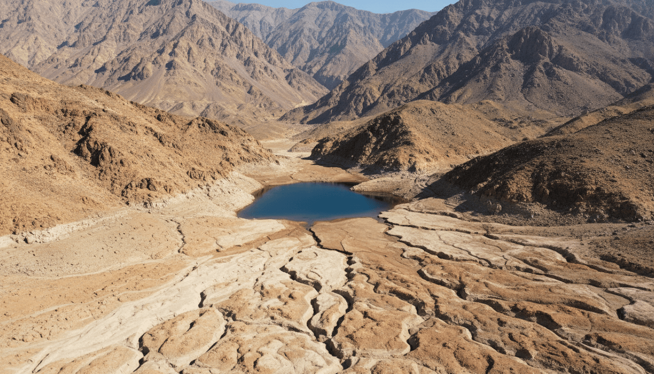
Hanna Lake, Quetta: History, Water Conditions and Visitor Context
A practical, source-based guide to Hanna Lake and Hanna–Urak near Quetta, explaining its water setting, drought-sensitive appearance, provincial projects and how to verify current access.
Hanna Lake is one of the most searched natural landmarks near Quetta, often shown as permanently full beneath ochre hills. In reality, its appearance and recreational use depend on rainfall, catchment flow, sediment, infrastructure and water management in an arid basin. Balochistan's Water Policy identifies Hanna Lake among important provincial wetlands, while public development programmes record projects in the Hanna–Urak area. These official sources establish environmental and planning context, not today's water level, opening status or road safety. This guide explains what remains stable and what a visitor must verify immediately before a trip.
Key points
- Hanna Lake's water level is variable; an undated photograph is not a current conditions report.
- The lake belongs to the wider Quetta basin and Hanna–Urak catchment rather than functioning as an isolated attraction.
- Government project listings document allocations and targets, not automatic proof of completion or operating quality.
- Current access, weather, facilities and security should be confirmed locally close to the visit.
Where Hanna Lake fits in the Quetta basin
Hanna Lake lies near Quetta in a high, dry landscape where mountain catchments feed seasonal flows. The lake and nearby Urak area are commonly linked in recreation and public planning. Distance estimates depend on the point used within Quetta and the road alignment, so maps should provide a route rather than one universal kilometre figure.
The basin setting explains the contrast between popular blue-water photographs and periods of very low water. Rainfall may be localized, runoff may be delayed and upstream conditions matter. A weather forecast for central Quetta does not fully describe the catchment, while one rainy season cannot establish a long-term recovery.
Water, drought and wetland significance
The Balochistan Water Policy lists Hanna Lake among less-documented provincial wetlands and places it within a broader discussion of biodiversity and water stress. That designation is useful, but it does not supply a continuous gauge record. Claims about depth, capacity or complete drying need a dated technical source with a measurement method.
Sediment, damaged channels, extraction and land-use change can affect how rainfall reaches a lake. Separating meteorological drought from infrastructure and management questions prevents simplistic explanations. Long-term analysis should compare rainfall, inflow, storage, groundwater and maintenance across several years rather than relying on before-and-after images.
History and engineered landscape
Hanna is often called a natural lake in casual travel writing, yet its present recreational identity is tied to water-control infrastructure and managed landscape. Historical claims about construction dates and purposes should be checked in engineering or archival records. Repeated unsourced dates online are not independent confirmation.
The lake's history also includes local labour, recreation, drought and changing public investment. Treating it as a timeless colonial picnic site would miss community use before and after particular projects. Oral histories and dated photographs can add that social record when their creators, locations and dates are preserved.
What provincial development records prove
Balochistan's Public Sector Development Programme records projects for Hanna–Urak beautification and a recreational hill point near Hanna. A budget line proves that a scheme was listed with a stated allocation and target at that publication date. It does not by itself establish full completion, current maintenance, free public entry or environmental benefit.
To evaluate a project, follow later releases, procurement records, completion reports and on-site evidence. Keep project title and fiscal year together. Search engines often present an old allocation as current news, which can lead visitors and researchers to describe planned facilities that do not exist or are no longer operating.
Visitor planning without false certainty
Before travelling, verify road access, lake conditions, public opening, transport, weather and any official restrictions through current local sources. Bring water and clothing appropriate to a highland climate, but follow local safety guidance rather than a generic packing list. Do not enter dry channels when storms are possible upstream.
Respect barriers, waste rules and photography restrictions. Low water can expose unstable mud and infrastructure; it is not an invitation to walk everywhere. Avoid promising boating, food stalls or a particular view unless a dated operator or authority confirms them for the planned day.
How Hanna connects to the regional topic centre
The Quetta guide explains the capital's basin, population and communities; the Balochistan guide supplies provincial water and census context. Bolan provides a comparison with another landscape shaped by episodic flows, while Ziarat shows a different highland ecology. These are direct same-language links, not a claim that every site shares one climate or management system.
For research, archive each lake observation with date, coordinates or named viewpoint, photographer, recent weather and source rights. A sequence of comparable observations is more valuable than a dramatic unsourced image. Update the page only when substantive evidence changes, and use that editorial date for sitemap lastmod.
How to read the evidence
Official statistics, government plans, UNESCO submissions, museum records and tourism pages answer different questions. Keep each source's geography, reference date, institutional role and uncertainty visible. Current access, weather, transport and security conditions must be checked close to the intended date.
Related Balochistan reading
- Quetta City: History, Geography, Population and Culture
- Balochistan Province: Map, Districts, Population and Geography
- Bolan Pass: Geography, History and the Route to Quetta
- Ziarat, Pakistan: Juniper Forest, Heritage Status and Ecology
Sources
These sources are linked for verification. A UNESCO Tentative List entry is not a World Heritage inscription, a budget line is not proof of completion, and an institutional plan is not an observed outcome.
- Government of Balochistan — Balochistan Water Policy 2024 — Provincial policy evidence on aridity, water management and wetlands, including Hanna Lake.
- Government of Balochistan — Public Sector Development Programme 2023–24 — Official programme record for tourism and public works at Hanna–Urak, Kund Malir and other provincial sites.
- Government of Balochistan — Provincial portal — Official provincial overview and government information, including the province's area and administrative context.
- Balochistan Bureau of Statistics — Statistics and district profiles — Official statistics hub with district profiles and provincial indicators; administrative listings may post-date the 2023 census reference date.
- Pakistan Bureau of Statistics — Provincial Census Report 2023: Balochistan — Official provincial report describing census geography, population and settlement patterns at the reference date.
- Pakistan Bureau of Statistics — 2023 Census — Official census hub for definitions, reports, tables and the 2023 reference period.


