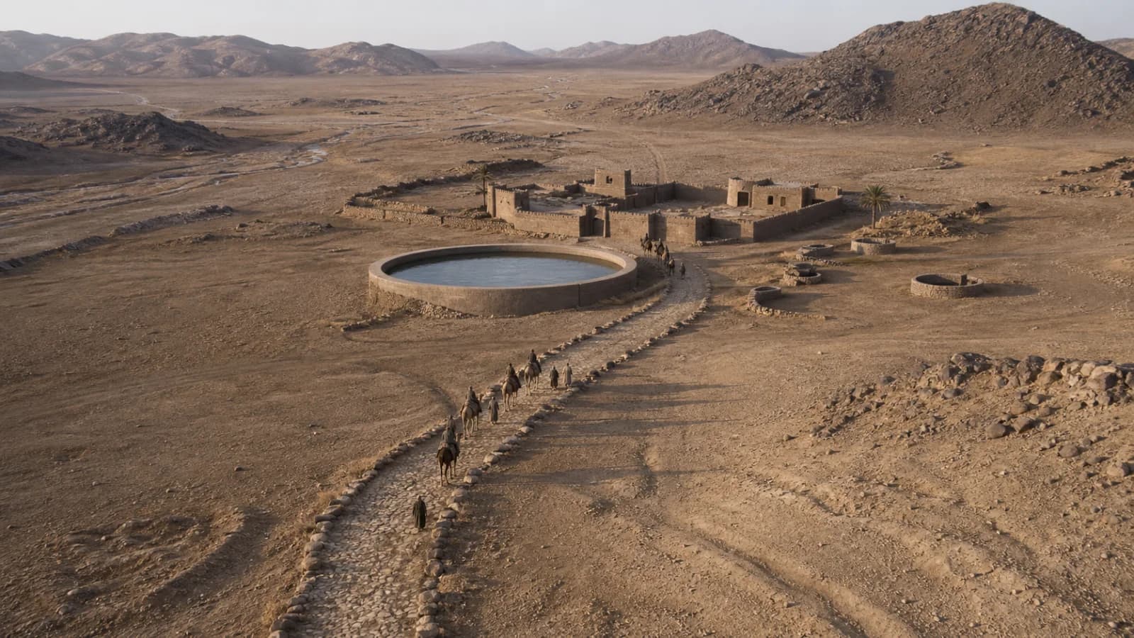
Darb Zubaydah: Abbasid Hajj Road from Kufa to Makkah
Trace the 1,300 km Darb Zubaydah and learn how Abbasid wells, cisterns, stations and milestones supported pilgrims from Kufa to Makkah.
Darb Zubaydah was the great pilgrimage road between Kufa in Iraq and Makkah. Across roughly 1,300 kilometres, it joined religious travel to a planned system of waterworks, stations, road markers and administration. Its remains show that a hajj route was not simply a line across a map: it was infrastructure that had to keep people and animals alive through deserts, lava fields and mountains.
The cover image is an original AI-assisted historical reconstruction, not an archaeological photograph.
Why is it called Zubaydah's road?
The route is associated with Zubaydah bint Ja'far, wife of the Abbasid caliph Harun al-Rashid. She funded charitable works for pilgrims, and later sources attached her name—or Umm Ja'far—to many wells, reservoirs and stations. This does not mean that she created the entire road from nothing. Travel between Iraq and the Hijaz was older; Abbasid rulers, officials, patrons and workers expanded, repaired and organized a much larger network. The name remembers exceptional patronage, while the surviving landscape records collective labour over generations.
Water engineering made the route possible
Water was the decisive constraint. Builders dug wells into rock, caught seasonal runoff behind dams, lined cisterns, cleared channels and created large open reservoirs. A station could combine several systems because one failed rain or a silted pool could endanger a convoy. Some road sections were cleared or paved, while milestones and markers helped travellers hold a course across visually repetitive terrain.
The engineering was adapted to place rather than copied from one template. A wadi might feed a rectangular or circular pool; a rocky zone required deep lined wells; a station near cultivated land could support storage and exchange. Archaeological remains include reservoirs, canals, wells, forts, mosques, houses, caravan facilities and cemeteries.
Stations formed a communications network
Stations were positioned at practical intervals measured in miles or barid, a term also connected with the Abbasid postal system. Fayd served as an important midpoint and supply centre. Al-Tha'labiyya and al-Rabadha marked major stages. Large stations offered water, shelter, security and markets; smaller substations increasingly served people travelling on foot.
The road therefore carried more than pilgrims. Couriers, officials, traders and military parties also used it. The same infrastructure that supported worship linked Iraq, Arabia and the Abbasid state. That overlap between devotion, public charity and administration is central to understanding the route.
Change, decline and survival
The route flourished especially in the early Abbasid centuries. Political fragmentation and weakening communications between Iraq and Makkah reduced organized traffic after the tenth century. Parts were revived, but the network never returned to its early scale; UNESCO's nomination dossier records the last organized Abbasid pilgrimage convoy on the route in 1243 CE. Later travellers used other alignments and transport systems.
Today, Darb Zubaydah is on the UNESCO World Heritage Tentative Lists of Saudi Arabia and Iraq. Tentative-list status is a step toward possible nomination, not the same as inscription on the World Heritage List. Surviving stations remain archaeological sites, and their condition varies. The clearest way to read them is to ask where water entered, how it was stored, how travellers moved between buildings and how each station related to the next.
Key facts
- Route: Kufa to Makkah, approximately 1,300 km.
- Main period of monumental development: the Abbasid era.
- Core infrastructure: wells, cisterns, dams, channels, stations, markers and selected paved stretches.
- Historical role: pilgrimage, trade, postal communication and administration.
- Heritage status: a transnational Saudi-Iraqi property on UNESCO's Tentative Lists, not yet an inscribed World Heritage Site.
Sources
- UNESCO World Heritage Centre: Darb Zubaydah (Saudi Arabia) — route length, stations, engineering and nomination status.
- UNESCO World Heritage Centre: Darb Zubaydah (Iraq) — the Iraqi section and transnational context.
- Saudi Heritage Commission: Darb Zubaydah Initiative — current research, protection and nomination programme.
- Saudipedia: Antiquities in Northern Borders Province — stations, pools, wells and route markers.


