How an Islamic Astrolabe Worked: Mater, Rete, Plates and Alidade
A visual guide to the planispheric astrolabe, its main parts, how altitude was measured and how astronomers used it for time and direction.
A planispheric astrolabe is a flat analogue model of the sky, not a clockwork machine. It combines a stereographic projection of the celestial sphere with rotating parts that let a trained user connect a star or the Sun to local time, altitude and direction.
Astrolabes were made in many regions and languages. Instruments from the Islamic world often carried Arabic or Persian inscriptions and could include scales or tables for prayer times and qibla-related work, but no single instrument had every possible function.
The mater holds the instrument
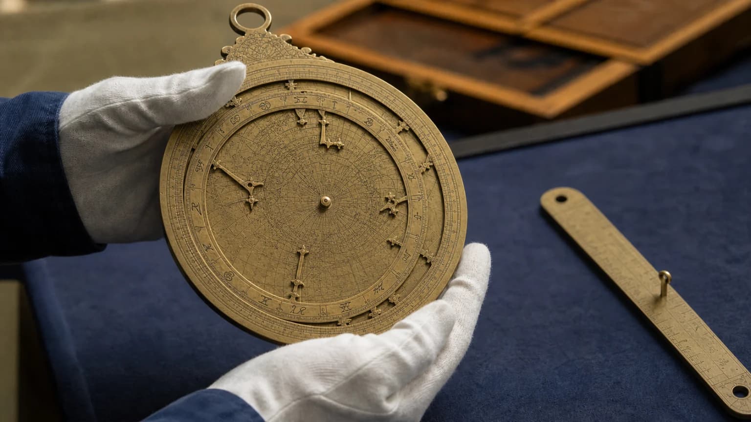
The mater is the main circular body. Its raised rim carries scales, while its recessed centre holds one or more plates. A suspension ring lets the instrument hang vertically when altitude is measured.
Plates, sometimes called climates, are engraved for particular latitudes. Their curves represent the horizon and altitude circles for an observer at that latitude. Changing location may require a different plate.
The rete is a map of bright stars
The rete is the openwork rotating framework on the front. Star pointers mark selected bright stars, and a zodiac circle represents the Sun's annual path. Rotating the rete over a latitude plate models the sky's apparent daily motion.
A rule on the front can help read coordinates or align positions. The exact construction varies, so object catalogues should be consulted before naming a part on a particular instrument.
The alidade measures altitude
On the back, a rotating sighting rule called an alidade is used while the astrolabe hangs vertically. The user sights a star—or measures the Sun with appropriate indirect technique—and reads its altitude from a graduated scale.
That observation is then transferred to the front by rotating the rete and rule. With the correct plate and date, the alignment can answer practical astronomical questions such as local time or the sky's orientation.
- Mater: the body and rim.
- Plate: the latitude-specific coordinate grid.
- Rete: the rotating star map and zodiac circle.
- Alidade: the rear sighting rule used to measure altitude.
What astrolabes could and could not do
Astrolabes supported teaching, observation, timekeeping, surveying and some religious calculations. They did not automatically “find anything” without tables, training and the correct settings. A museum record's date, maker, latitude plate and inscriptions are essential evidence for understanding one object.
Sources
- British Museum: Seeing Stars — Astrolabes and the Islamic World — Explains the principal components and uses of astrolabes in the Islamic world.
- British Museum: Astrolabe Collection Object — Provides object-level evidence for materials, construction and inscriptions.
- British Museum: Astrolabic Quadrant — Shows how related astronomical instruments differed in form and operation.
- The Metropolitan Museum of Art: Planispheric Astrolabe — Provides object-level details for a dated seventeenth-century Iranian astrolabe.
- History of Science Museum, Oxford: The Planispheric Astrolabe — Defines the mater, plates, rete, rule and alidade and explains their operation.
- Science Museum Group: Islamic Astrolabe — Documents an early Syrian planispheric astrolabe and its surviving parts.
Related guides
- Explore Islamic astronomy and instruments
- Read about al-Biruni and geodesy


